Intro
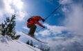
This route descends from near the summit of Konjushka Peak (2,571 m), which sits directly on the Kosovo–North Macedonia border inside Sharr Mountains National Park, down to Krojet in Prevalla — 4.58 km and 940 m of descent, 2,470 m to 1,543 m. Predominantly north and northwest-facing terrain holds snow well through the season. It finishes at an actual restaurant — Krojet, in Prevalla — which makes it a genuinely satisfying way to end a day: ski to a hot meal.
Grade
Provisional WS on the SAC ski scale, based on the angle data alone (96.8% of the corridor sits under 30°, with a real pitch up to 37° concentrated in the upper section near the peak).
Aspect & angle, one sentence
The upper mountain is consistently north to northwest-facing through every elevation band on this line, which is good news for snow retention but means the whole route shares one avalanche problem rather than several — if that aspect is loaded, the entire descent is affected, not just one section.
Route description, in stages
From near the Konjushka summit, the line drops steadily northwest-facing terrain through the steepest section of the route — this upper band (2,250 m down to 2,000 m) holds the steepest pitches, up to 37°. Below 2,000 m the angle eases into consistent, moderate valley skiing, staying mostly under 30° for the remaining descent into Prevalla and Krojet.
What a bulletin would tell you — and why there isn’t one
There is no avalanche bulletin for the Sharr Mountains, or anywhere in Kosovo. EAWS — the body that runs Europe’s avalanche warning services — has one Balkan member, Slovenia. If you’re used to checking a bulletin before you tour, that habit has nothing to check here.
What we can tell you instead: this descent is consistently north/northwest- facing from top to bottom, with the steepest ground (up to 37°) concentrated in the first 250 vertical metres off the summit. A single persistent or wind slab problem on a north-northwest aspect affects this entire line, not just one pitch — that’s different from a mixed-aspect route where one bad band still leaves you options. That’s observation, not forecast.
Border note
Konjushka Peak sits directly on the Kosovo–North Macedonia border. The crest of the mountain marks the border, while the whole trail is in Kosovo. On the borders with Albania and Montenegro, you can ski cross-border; however, this is not possible with Macedonia, as the state is very bureaucratic and does not allow simple border-crossing procedures. borde
Season window
Sharr mountains are known for a lot of snow and snow retention. This can be open from December to May however, safe and nice season is January to March.
Access
Finish: Krojet, Prevalla — the same trailhead village as the Prevalla–Guzhbaba route, making these two a natural pair for a multi-day itinerary.
Conversion block
This descent finishes in Prevalla, the gateway village for the Kosovo side of the Sharr Mountains — the same area covered in our Prizren, Kosovo trip. We ski it when the upper-mountain aspects have settled See the guided option
Table view
Sampled every 200 m. The full point-by-point data is in the GPX download.
Table view
Aspect by elevation band
Restricted to terrain of 25° or more — the ground where aspect actually matters. This is the format avalanche bulletins use, so you can carry it straight into your own assessment.
These figures come from a 30 m elevation model, resampled to a 25 m analysis grid. A model at that scale smooths steep ground: a genuine 45° couloir can read as 35°, and short steps between grid cells disappear entirely. Treat every angle here as a floor, not a ceiling, and verify on the ground.
Contours and hillshading from OpenTopoMap. Colour along the line follows the same slope classes as the profile.
Elevations sampled from Copernicus DEM GLO-30 (AWS Open Data) (30 m), analysis grid 25 m, EPSG:32634. Track recorded February 5, 2026 — conditions on that day only. A planning aid, not a recommendation.