Ski Touring Gjeravica: Kosovo’s Highest Peak on Skis
2,656 metres, four approaches, three countries in view
Gjeravica is the highest mountain in Kosovo, the second highest in the Accursed Mountains, and the sixth highest in the Balkan peninsula. It stands close to where Kosovo meets Albania and Montenegro, surrounded by glacial lakes, and it is the source of the Erenik river that runs down through Junik and Gjakova.
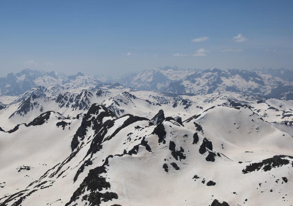
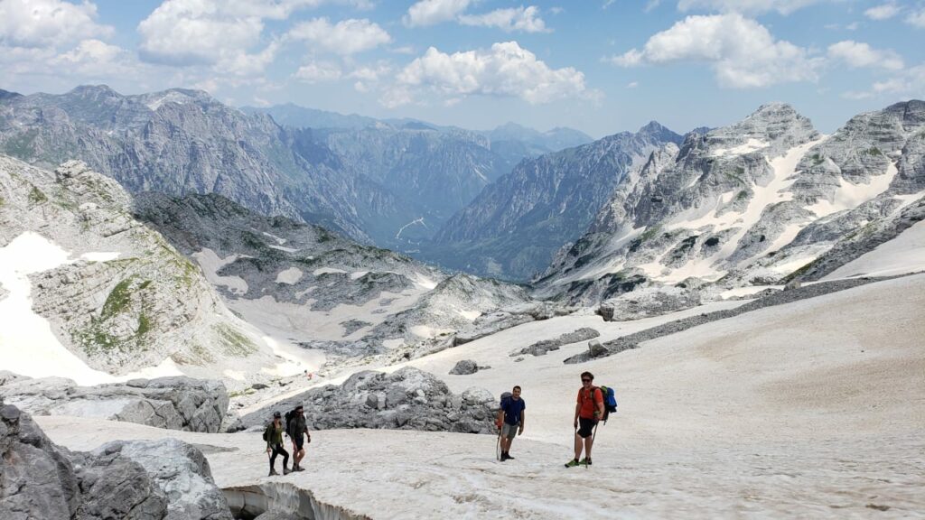
What sets it apart is how it sits in the landscape. Gjeravica stands almost alone — a giant, fearless and visible from much of Kosovo, which is why it is often described locally as the heart of the country. From the summit the view opens onto the Albanian Alps, the Prokletije, and nearly every mountain in Kosovo.
For ski tourers it is the defining objective of the Kosovar Accursed Mountains, and a genuinely serious one. This is not a valley tour with a summit attached. It is a long day from any direction, frequently icy in its upper third, and it does not belong on a first visit to the range.
A note on the title. At 2,656 m Gjeravica is officially the highest peak in Kosovo. Unofficially, Rudoka e Madhe (Veliki Rudoka) in the Sharr Mountains takes it by four metres at 2,660 m — but sits in a contested border zone, which is why the official designation stays with Gjeravica.
Why Ski Gjeravica
- It is the summit of the country. There is one highest peak in Kosovo and this is it. For many tourers that is reason enough.
- A genuine mountaineering objective. Unlike most touring in the Accursed Mountains, Gjeravica in winter routinely requires crampons and an ice axe. It is the one peak in the region that asks for alpine skills rather than just fitness and off-piste competence.
- Glacial lake basins. The approach passes Liqeni i Gjeravicës at around 2,300 m, with close, near-vertical views of the summit headwall rising above. Several other glacial lakes lie in the surrounding cirques.
- Four countries’ worth of view from one summit. The Albanian Alps, the Montenegrin Prokletije, and the full sweep of Kosovo’s mountains.
- A natural finale. On multi-day traverses through the Accursed Mountains, Gjeravica is the standard last day — climbed from Doberdol, then descended toward Kosovo and a transfer to Peja.
The Four Approaches
Gjeravica’s position at the meeting point of several valleys means there is no single standard route. Four winter approaches are in regular use, and the choice depends on where you are based and what you are traversing.
Gropa e Erenikut, Kosovo — East Side
The shortest ascent. Gropa e Erenikut is a small settlement on the eastern flank, reached by 4×4 from Junik or Peja. The route passes the Gaçaferri mountain huts and climbs past the glacial lakes to the summit. In summer conditions the round trip runs about 12.8 km with 930 m of ascent over six to seven hours; in winter, with snow and a longer approach drive, plan for considerably more. This is the standard choice for anyone climbing Gjeravica as a single objective rather than as part of a traverse.
Doberdol, Albania — West Side
The classic traverse approach, and the one most guided ski programmes use. From Doberdol guesthouse at 1,740 m the route climbs to the Ali Peja Pass at 2,275 m on the Albania–Kosovo border, then continues to the summit. The descent typically runs east into Kosovo, finishing with a transfer to Peja. This is the natural final day of a Peaks of the Balkans ski traverse.
Rupa Dobroš, Kosovo — Northwest Side
A tiny hamlet near the Albanian border, accessed from the village of Deçan via the Deçan valley. Less travelled than the other options and a good choice for anyone already based in the Rugova/Deçan sector.
Bogićevica, Montenegro — West Side
The longest approach, originating from the Bogićevica summer katun and crossing into Kosovo via Qafa Bogićes. Worth knowing that border patrols are more likely on this line than the others, since there is road access nearby — carry your permits.
Where the routes meet. The three western approaches (Rupa Dobroš, Bogićevica and Doberdol) intersect at Liqeni i Tropojës and the Ali Peja Pass on the Albania–Kosovo border. The single eastern route from Gropa e Erenikut joins higher up.
Winter Conditions on the Mountain
The critical detail, and the one most trip reports understate: above roughly 2,400 metres the snow on Gjeravica frequently turns to ice. Parties climbing in winter regularly switch to crampons and ice axes for the final section, and ski crampons are advisable well below that.
This changes the character of the day entirely. A cold snap that firms the snowpack can make the approach faster and easier while making the summit block harder and more consequential. The near-vertical aspect of the summit seen from the lake below is not an illusion — the upper mountain is steep, and a slip on ice there is not recoverable.
Plan the ascent so that turning back below the ice line is an acceptable outcome. The glacial lake basin at 2,300 m is a worthwhile destination in its own right, and treating the summit as conditional rather than assumed is the right frame for this mountain.
Practical Information
| Summit elevation | 2,656 m — highest in Kosovo, 2nd in the Accursed Mountains, 6th in the Balkans |
| Location | Western Kosovo, near the Albanian and Montenegrin borders |
| Approaches | Gropa e Erenikut (Junik, shortest); Doberdol (Albania); Rupa Dobroš (Deçan); Bogićevica (Montenegro) |
| Typical ascent | c. 930 m from Gropa e Erenikut; longer from all western approaches |
| Best season | February to March; stable high pressure essential |
| Difficulty | Advanced. Not technical in good conditions, but frequently icy above 2,400 m |
| Additional gear | Crampons, ice axe, ski crampons |
| Access | 4×4 from Junik or Peja to Gropa e Erenikut; guesthouse bases at Doberdol and Deçan |
| Borders | Western approaches cross or follow the Albania–Kosovo and Montenegro–Kosovo borders — permits required |
| Nearest towns | Junik, Deçan, Peja |
Safety and Avalanche Awareness
Gjeravica is the most serious objective covered on this site, and the gap between its summer reputation as a moderate hike and its winter reality is wide. In summer it is a marked trail suitable for anyone with basic hiking experience. In winter it is an alpine ascent on a remote mountain with no rescue infrastructure above the valley.
Ice above 2,400 m is the defining hazard. Crampons and an ice axe are not optional additions — they are the difference between a manageable day and an unrecoverable fall. Anyone without experience using them on steep terrain should not be on the upper mountain.
The approaches are long and the glacial cirques below the summit are classic terrain traps: enclosed basins beneath steep loaded slopes, where a release has nowhere to run out. There is no avalanche forecast for the Accursed Mountains and no snow reporting. Assessment falls entirely on the party.
Mobile coverage on the mountain is absent. The Rugova mountaineering rescue group is the nearest organised capacity, and it is a volunteer body — a response measured in hours, not minutes. A satellite communicator is strongly advised.
Full avalanche equipment — transceiver, probe, shovel — and the training to use it are mandatory. For anyone unfamiliar with the mountain, a certified local guide is strongly recommended rather than merely suggested.
Plan Your Trip
See our guides to the Accursed Mountains and Rugova, or book a guided ski touring trip via Balkan Natural Adventure.