Table view
Sampled every 200 m. The full point-by-point data is in the GPX download.
Table view
Aspect by elevation band
Restricted to terrain of 25° or more — the ground where aspect actually matters. This is the format avalanche bulletins use, so you can carry it straight into your own assessment.
These figures come from a 30 m elevation model, resampled to a 25 m analysis grid. A model at that scale smooths steep ground: a genuine 45° couloir can read as 35°, and short steps between grid cells disappear entirely. Treat every angle here as a floor, not a ceiling, and verify on the ground.
Contours and hillshading from OpenTopoMap. Colour along the line follows the same slope classes as the profile.
Elevations sampled from Copernicus DEM GLO-30 (AWS Open Data) (30 m), analysis grid 25 m, EPSG:32634. This is a drawn line, not a recorded track: it carries no evidence about conditions on any particular day. A planning aid, not a recommendation.
Guide’s Take
Brezovica is one of the best-known ski destinations in Kosovo, located in the heart of the Sharri Mountains. The ski resort has a long history and is surrounded by high mountain terrain, making it a great starting point for ski touring and exploring some of the wilder slopes of the area.
Beyond the marked pistes, there are plenty of opportunities for more adventurous skiing, but the terrain also requires good judgement and awareness of the conditions.
We start our tour either by climbing alongside the ski slopes in the direction of Piribreg Peak, or, more commonly, by taking the chairlift up to a certain point and starting our ascent from there.
From the lift, we continue on foot or on skis, depending on the conditions, before descending slightly towards Rrafshi. From there, the main climb begins, taking us up towards Black Rock Peak.
The summit offers beautiful views across the surrounding Sharri Mountains, and on a clear day, the landscape is impressive in every direction. However, this area can be tricky when the weather changes. The terrain forms a kind of natural bowl, where fog can develop and reduce visibility quite quickly, making navigation more challenging.
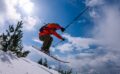
The descent from Black Rock Peak is steep and best suited to advanced skiers. There are many rocks along the way, so careful line selection is essential, especially when snow cover is limited. This side of the mountain is locally known as Potoki, and although it offers an exciting descent, it is also an avalanche-prone area. The snowpack and recent weather conditions must be assessed carefully before skiing this slope.
In some conditions, it is also possible to climb towards the peak from the Potoki side, but this is generally not the preferred option. The route can involve steep climbs and icy sections, while softer snow can bring additional avalanche risk. For these reasons, the approach from the upper ski resort is usually the more practical choice, provided conditions are suitable.
Overall, Black Rock Peak is a more demanding ski tour, combining a rewarding climb with challenging, steep terrain on the descent. It’s a great objective for experienced ski tourers looking for something more adventurous around Brezovica, but good visibility, stable snow conditions and careful route planning are especially important here